
TessaDEM
TessaDEM is a near-global 30-meter Digital Elevation Model (DEM).
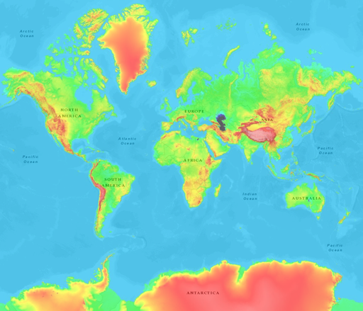
The aim of TessaDEM is to provide an elevation database representing the Earth terrain by combining 30-meter spatial resolution and tree height bias removal.
To achieve this, elevation data were merged and adjusted from multiple sources according to tree height, urbanization and water presence using AW3D30[1], MERIT DEM[2], Forest Height[3], World Settlement Footprint[4] and Global Surface Water[5].
Overview
Elevation data can be viewed on topographic-map.com which uses TessaDEM as the data source.
Specifications
- Covered area: 80°S to 84°N latitude.
- Spatial resolution: 30 meters
- Vertical accuracy: 2 meters or better for 58% of the data.
- Geoid reference: EGM96
Access
Use Elevation API to easily get elevation from latitude and longitude
Elevation API provides 3 modes (points, path and area), 3 formats (JSON, GeoTIFF and KML) and 2 units (meters and feet) to help you converting geographic coordinates to elevation data.
Or parse and decode raw binary data on your own
Intended for programmers who can code a binary data parser that complies with the technical specifications below.
Raw binary data
- Total size: 405 GB
- Data splitting: 22,551 files of 1° latitude x 1° longitude.
- File name: [latitude]_[longitude] of the lower left corner.
- File rows: 3,600
- File columns: 3,600 below 50° latitude; 2,400 between 50° and 60° latitude; 1,800 between 60° and 70° latitude; 1,200 between 70° and 80° latitude; 720 above 80° latitude.
- Data type: 16-bit signed short integer (little endian byte order).
- Data unit: meter
- No data value: -9999
License
TessaDEM is licensed under the Open Database License (ODbL) v1.0.
You are free to:
- Share: To copy, distribute and use the database.
- Create: To produce works from the database.
- Adapt: To modify, transform and build upon the database.
As long as you:
- Attribute: You must attribute any public use of the database, or works produced from the database, in the manner specified in the ODbL. For any use or redistribution of the database, or works produced from it, you must make clear to others the license of the database and keep intact any notices on the original database.
- Share-Alike: If you publicly use any adapted version of this database, or works produced from an adapted database, you must also offer that adapted database under the ODbL.
- Keep open: If you redistribute the database, or an adapted version of it, then you may use technological measures that restrict the work (such as DRM) as long as you also redistribute a version without such measures.
History
- October 5, 2022: v1.0 (original release)
- February 3, 2023: v1.1
Disclamer
Data accuracy cannot be guaranteed as the presence of buildings, steep slopes and other artefacts may alter spaceborne readings.
References
- AW3D30: https://www.eorc.jaxa.jp/ALOS/en/dataset/aw3d_e.htm
- MERIT DEM: https://agupubs.onlinelibrary.wiley.com/doi/full/10.1002/2017GL072874
- Forest Height: https://glad.geog.umd.edu/dataset/GLCLUC2020
- World Settlement Footprint: https://www.esa.int/Applications/Observing_the_Earth/Mapping_our_human_footprint_from_space
- Global Surface Water: https://global-surface-water.appspot.com